

Drones Buzzing On The Border Front: How BSF Aims To Transform Security With AI, GIS-Powered Centre, UAVs
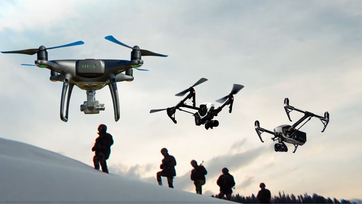
The newly launched command centre marks a shift from isolated field responses to coordinated, technology-driven oversight. Image Courtesy: RNA
The Border Security Force (BSF) is undergoing a quiet but decisive shift towards tech-led border management. Instead of relying solely on boots on the ground, it is now integrating drones, AI, GIS and radar-based systems to monitor infiltration, smuggling and hostile drone drops across the Pakistan and Bangladesh frontiers.
On Monday (September 29, 2025), the paramilitary force launched a new command and control system aided by artificial intelligence (AI) and geographic information system (GIS). The AI-enabled command centre aims to better the capability of the force in safeguarding the country’s borders with Pakistan and Bangladesh.
In addition to this, the BSF is also learnt to be working towards the development of drone mounted radar systems with the help of the Indian Space Research Organisation (ISRO). These systems will be used by troopers for surveillance along India’s western and eastern frontiers, The New Indian Express reported, citing officials.
Why has BSF intensified focus on drone-based surveillance?
Traditional patrolling faces challenges across the vast and varied landscapes of the western and eastern borders. From riverine zones and marshlands to densely populated belts and fog-prone sectors, constant human watchfulness is both difficult and risk-prone. The increased use of drones by Pakistan-backed smuggling networks and armed groups has further forced a tactical rethink.
Recently, the BSF troops thwarted multiple cross-border smuggling attempts, seizing heroin and drones along the Punjab border. The paramilitary force is responding to such threats by using its own drone fleets not only for reconnaissance but also for rapid intervention.
What role does new AI and GIS-enabled command centre play?
The newly launched command centre marks a shift from isolated field responses to coordinated, technology-driven oversight. Equipped with artificial intelligence and geographical information systems, it links surveillance feeds from drones, ground sensors, and cameras into a unified digital picture.
This real-time visual synthesis allows commanders to act quickly when infiltration attempts, suspicious activity or smuggling movements are detected.
How are drone operations being integrated into daily border management?
Drones are now being used both as a first line of surveillance and as a support element for troops on the ground. They provide visual and thermal coverage during daytime and night-time operations, particularly in sectors prone to infiltration and cross-border drops. When a drone spots movement, the feed is instantly transmitted to the command centre.
This shortens decision-making time and eliminates the risk of delayed alerts or fragmented communication.
What are radar-mounted drones and why are they crucial?
The BSF’s plan to induct drones fitted with compact radar systems adds another dimension to monitoring. These upgraded UAVs can detect movement beyond normal visual or camera range, making them useful in fog, dense vegetation and low-light conditions.
They are expected to play a key role in areas like Punjab and Jammu where smugglers increasingly use modified drones to transport drugs and weapons. Once airborne, radar-backed drones can sweep larger sectors and detect smaller, low-flying objects that standard optical systems may miss, TNIE report added.
“Their biggest advantage is that they operate day and night and in all weather conditions, whether foggy, dark or rainy. Radar-equipped drones can quickly detect the movement of moving targets, small vehicles, or intruders. This provides the BSF with real-time alerts, allowing the forces to act quickly,” an officer said.
Challenges differ across borders. Along Pakistan, the concern is weapon drops, narcotics consignments, and reconnaissance attempts from across the fence. On the Bangladesh side, the issue is illegal crossings, cattle trafficking and exploitation of riverine routes. Radar-mounted drones and AI-coordinated surveillance allow BSF to identify and respond to these threats before they escalate into breaches.
How AI and GIS enhance the power of drones?
Artificial intelligence reduces human fatigue by recognising patterns and differentiating between human movement, animals or vehicular activity. When suspicious movement is detected, the system immediately alerts duty officers. GIS then marks the activity on digitised border models, displaying coordinates and access routes for response teams.
Instead of manually scanning live feeds or relying on radio callouts, BSF personnel receive mapped intelligence. This creates a shift from reactive patrolling to predictive monitoring.
Moreover, drone inputs have become central to anti-smuggling campaigns. Narcotics drops via drones have escalated along the Punjab border, and coordinated tech monitoring is being used to track their flight paths, capture visuals of handlers and record GPS patterns.
The adoption of AI and GIS is a clear signal that the BSF is no longer only watching the border, it is mapping it, interpreting it and pre-empting breaches.